If you don’t see any of the download or export options, you may not have access to these features. Please contact your Sales representative.
Accessing anomalies data
Each Inspection adds data to the anomalies layer of your digital twin. For optimum experience, we advise that you access your inspections on the Raptor Maps platform. You can browse the anomalies layer a number of ways: on an map-based interface, as an interactive PDF, or as interactive tables.
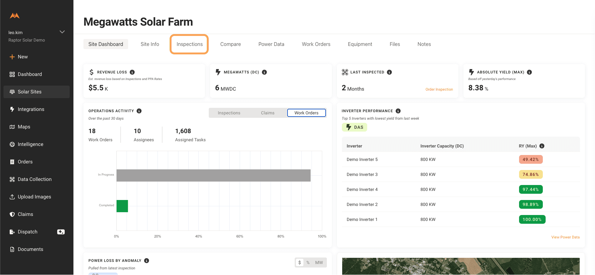
Select a Solar Site from the Solar Sites page
Select the “Inspections” tab
Select the Inspection Results you want to see
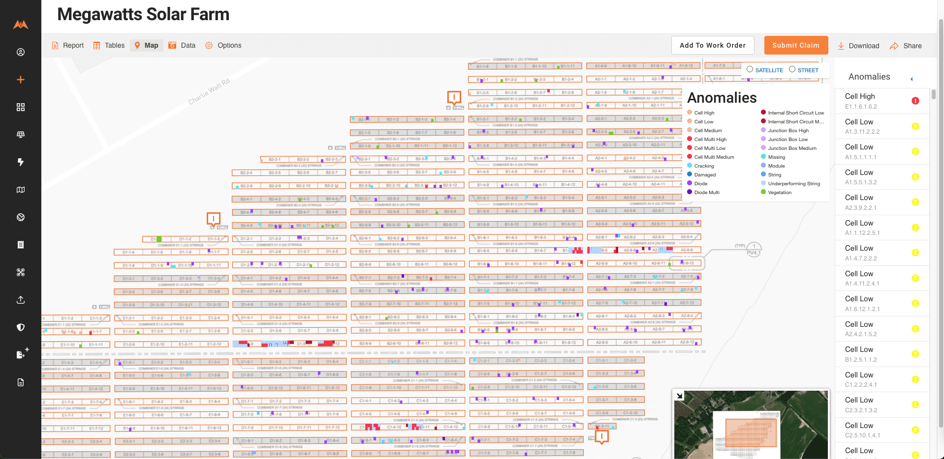
To view your Inspection report in our Digital Twin, navigate to the "Map" tab
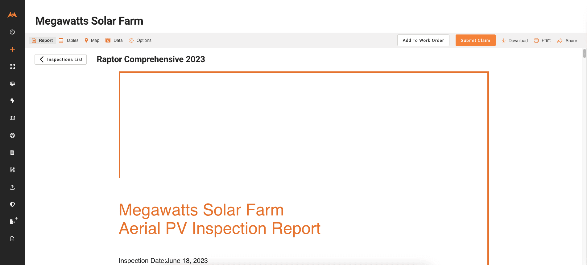
To view your Inspection report in an interactive PDF, navigate to the “Report” tab
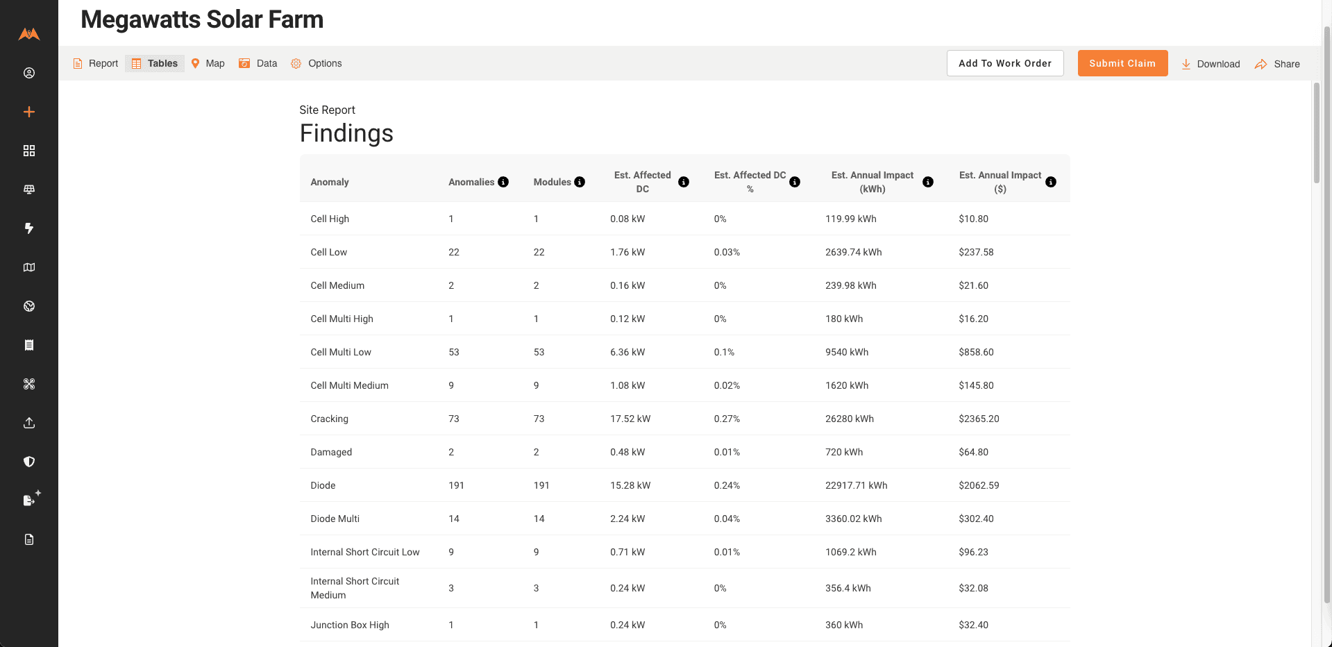
To view interactive tables, click on the "Tables" tab
Sharing inspection reports
See Analytics & Report Share Links and User Management
Downloading inspection reports
If you need to download an inspection report and / or data from the anomalies layer of the digital twin, you have several options:
Generate a PDF and .DOCX of your report
Download an Excel, CSV, KML or SHP of your anomalies dataset
Download images of anomalies
Send and receive data via API (see our API documentation)
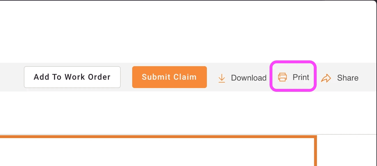
To generate a PDF of your report, navigate to an inspection report, select "Print" from the top menu bar and specify "Save as PDF" as the destination:
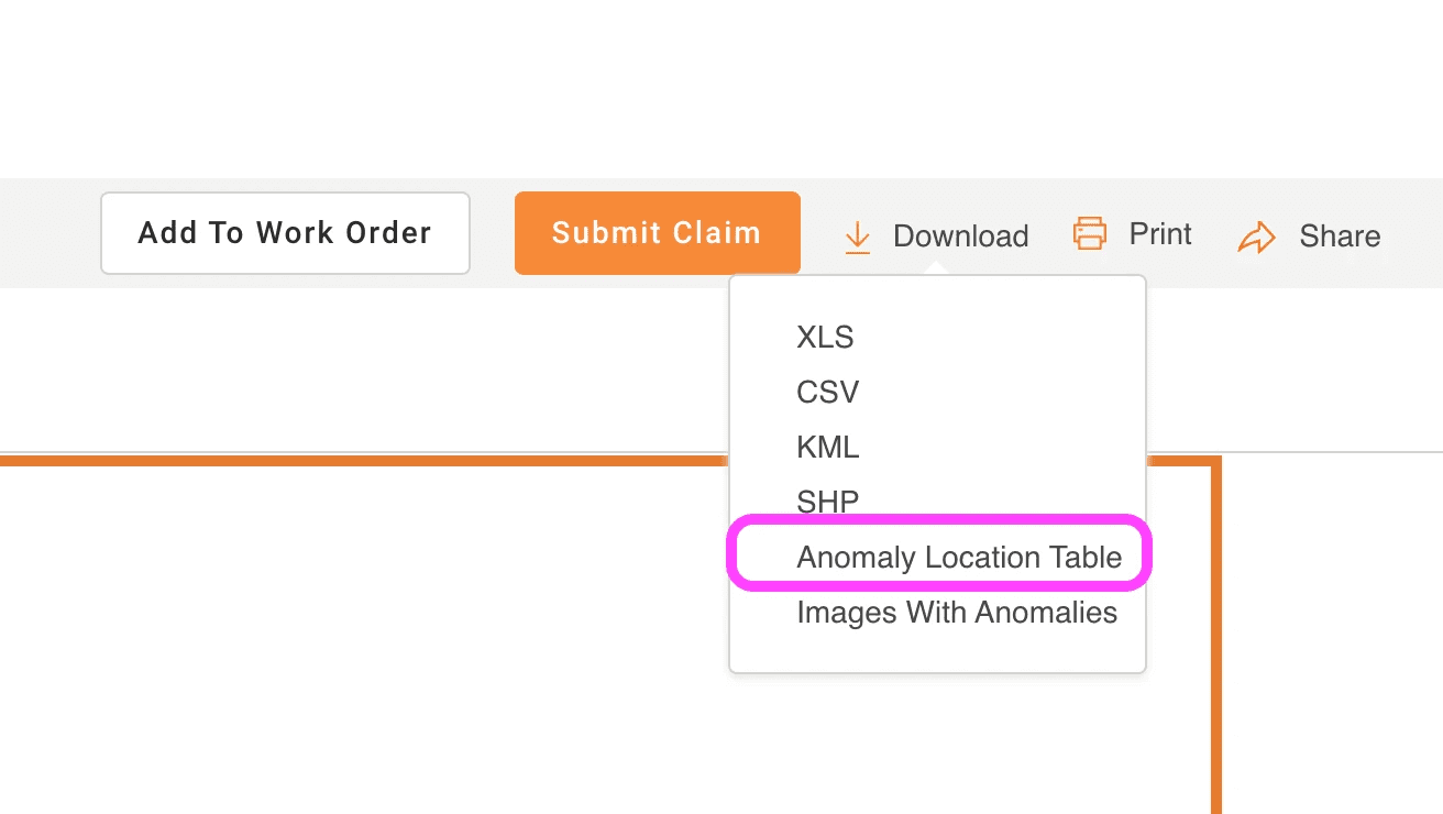
Note: if there are over 750 anomalies in your report, the PDF will not contain the table of anomalies. You will also need to download the “Anomaly Location Table” .DOCX file.
To generate a .DOCX file containing the Anomaly location portion of the report, select "Download" and then "Anomaly Location Table". You will then shortly receive a .DOCX file of the anomaly-locations table via email.
To download an Excel, CSV, KML or SHP of your anomalies dataset, select Download and then select your preferred format.
To download images of anomalies, and then select Download and then select your preferred format. You will then shortly receive a .DOCX file of the anomaly-locations table via email.