The DJI M200 series drone with a Zenmuse XT2 with 640×512 resolution and 13 mm or 19 mm lens can meet the data requirements quickly and efficiently. When used with DJI Ground Station Pro it is possible to automatically collect 70% front lap and 20% side lap thermal and RGB imagery.
Equipment
Drone: DJI M200 series (M200 or M210)
Camera: DJI FLIR Zenmuse XT2
Computer: iOS device (iPad)
Flight Planning Software: DJI Ground Station Pro, DJI XT Pro
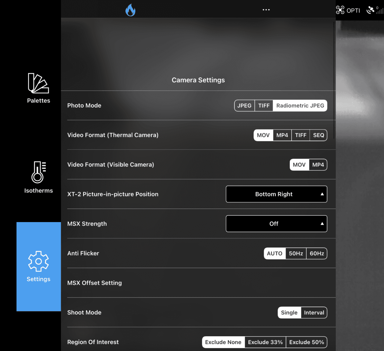
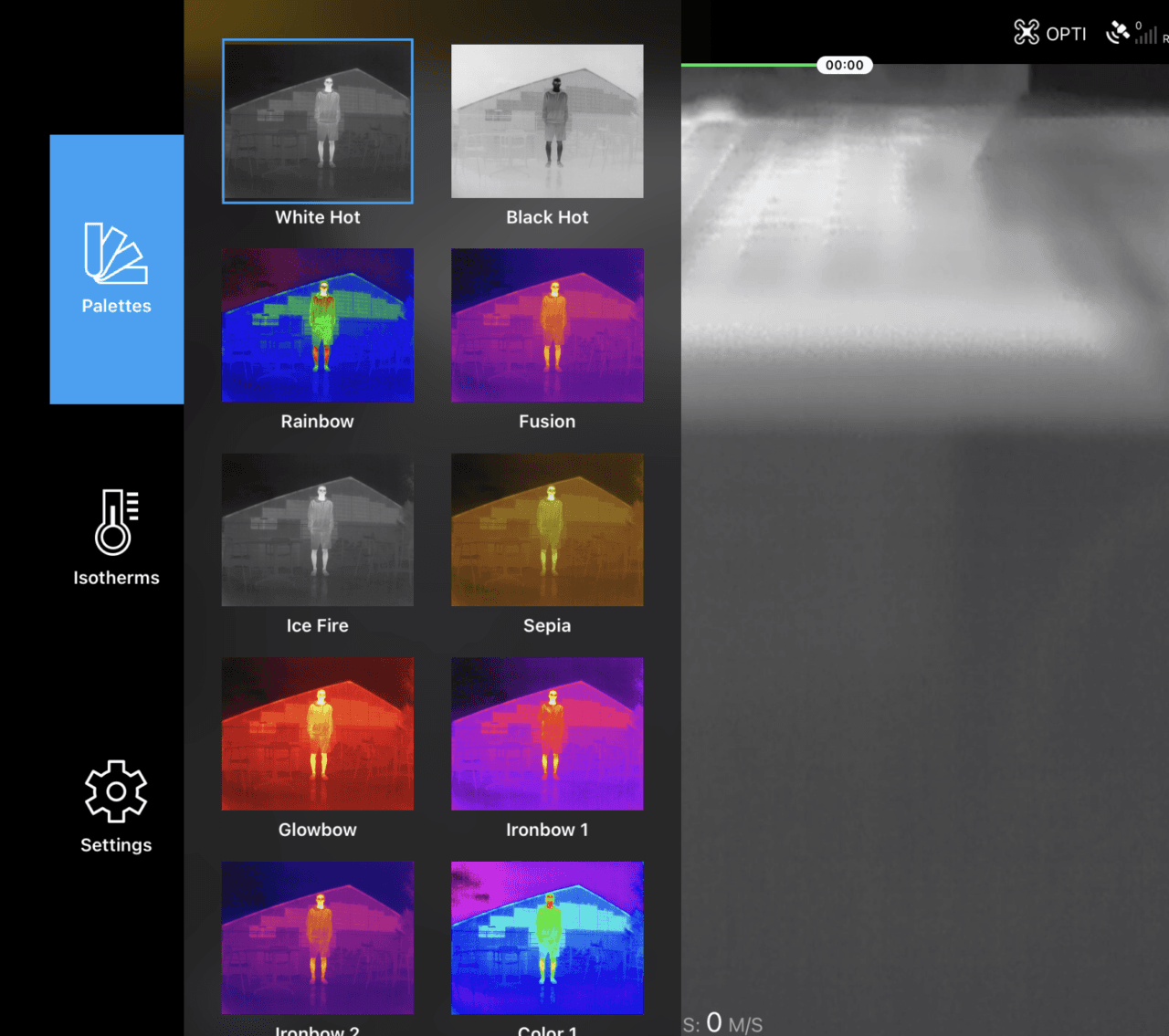
Camera Settings
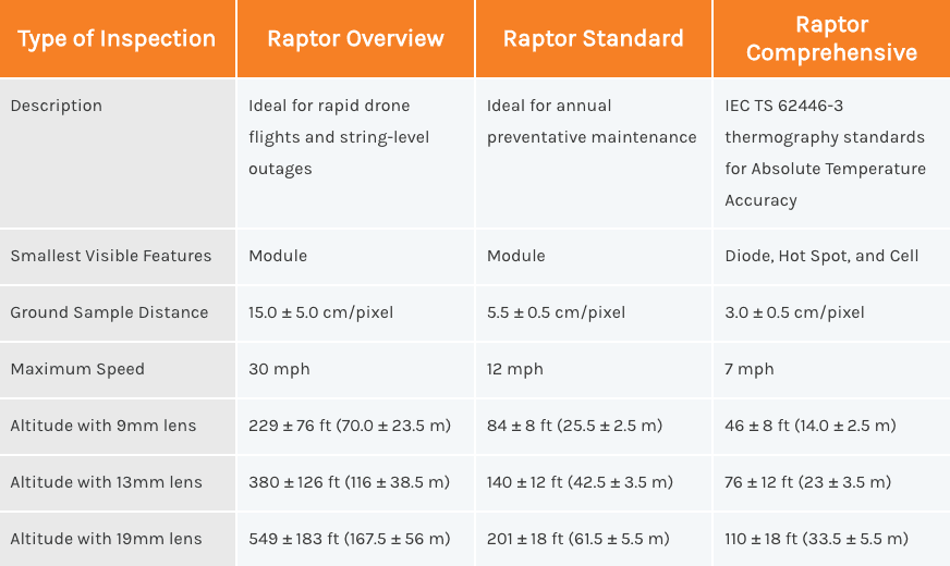
Camera Model: Zenmuse XT 13mm
Palette: White Hot
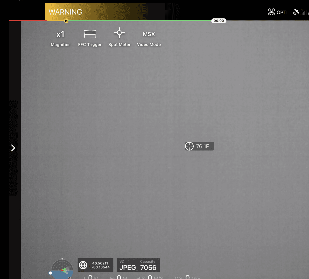
Magnification: 1x
MSX Mode: Strength=Off
Photo Mode: Radiometric JPEG
Flight Mission Planning Settings
Basic:Shooting Angle: Perpendicular to MainPath
Capture Mode: Capture at Equal Time Interval
Flight Control Mode: Inside Mode
Speed: Set shutter interval to 2.0 SEC
Height: See table below
Obliques
Note: Obliques / High flys are required as part of the flight. For information about how to correctly fly and take oblique images, please see Capturing Oblique Images.
Note: Altitude is calculated from panels, not from ground. Check local laws and regulations to determine maximum allowable altitude.
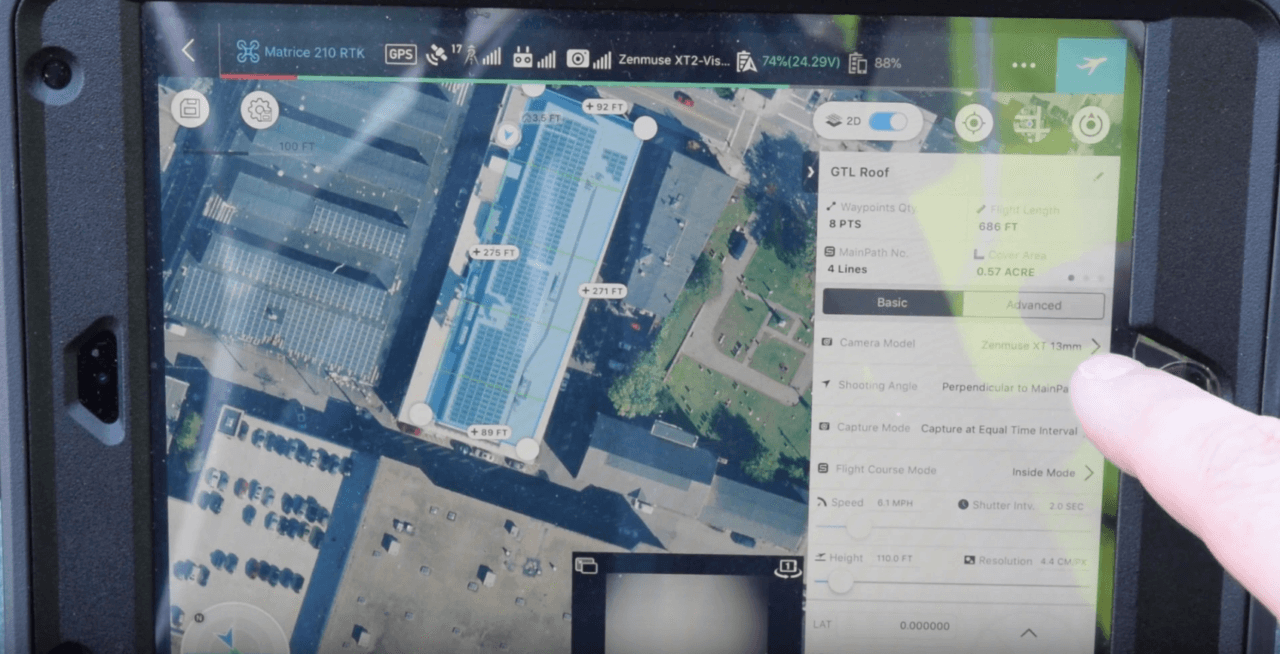
Advanced:
Front Overlap Ratio: 80%
Side Overlap Ratio: 20%
Course Angle: Parallel with solar row angle
Margin: 0.0 ft (margin should be provided in drawing the flight polygon)
Data Example
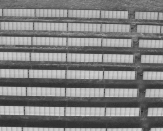
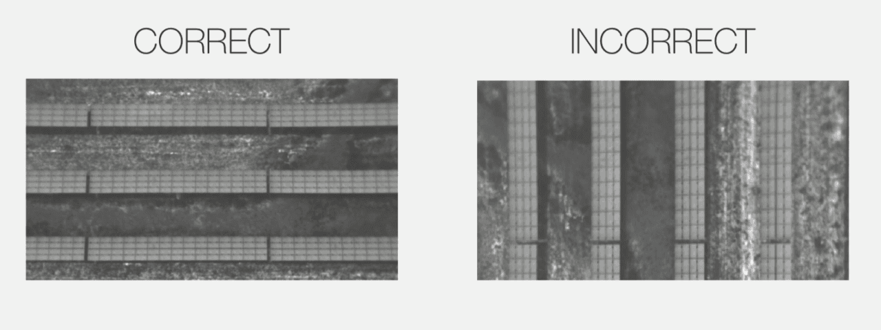
The long edge of the solar row aligns with the long edge of the image.
The following animation is a great example of Standard-level imagery collected with a ground sampling distance (GSD) of 5.5 cm/pixel with 80% frontlap and 20% sidelap. As you can see about 4-5 solar rows are visible in the imagery. This imagery was collected with a DJI Zenmuse XT2 camera with a 13 mm lens at a flight altitude of approximately 130 feet above ground level.