Raptor Maps requires both "as-builts" and .kml/.kmz of your sites.
Providing as-builts
Raptor Maps requires complete electrical site drawings (“as-builts”) to be provided in order to complete site digitization. Drawings should include overall site layout as well as detailed electrical wiring pages, see examples shown below.
If you are unable to provide complete electrical drawings report quality may be negatively impacted.
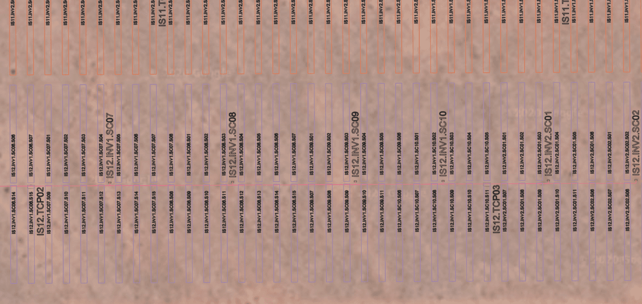
Pages show specific inverter, combiner, and string wiring and labeling:
The as-built you provide should include the string layout for the site, as shown in this example.
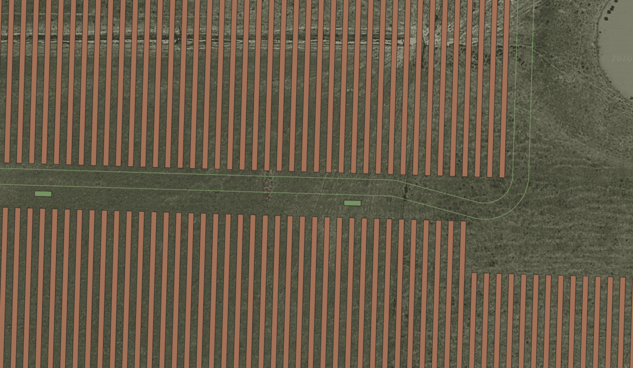
An as-built such as this one does not provide sufficient information:

This as-built does not provide the details required by Raptor Maps.
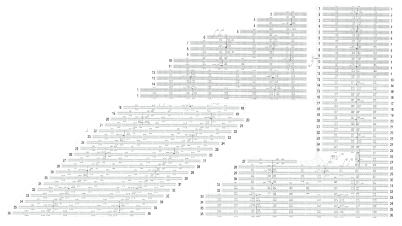
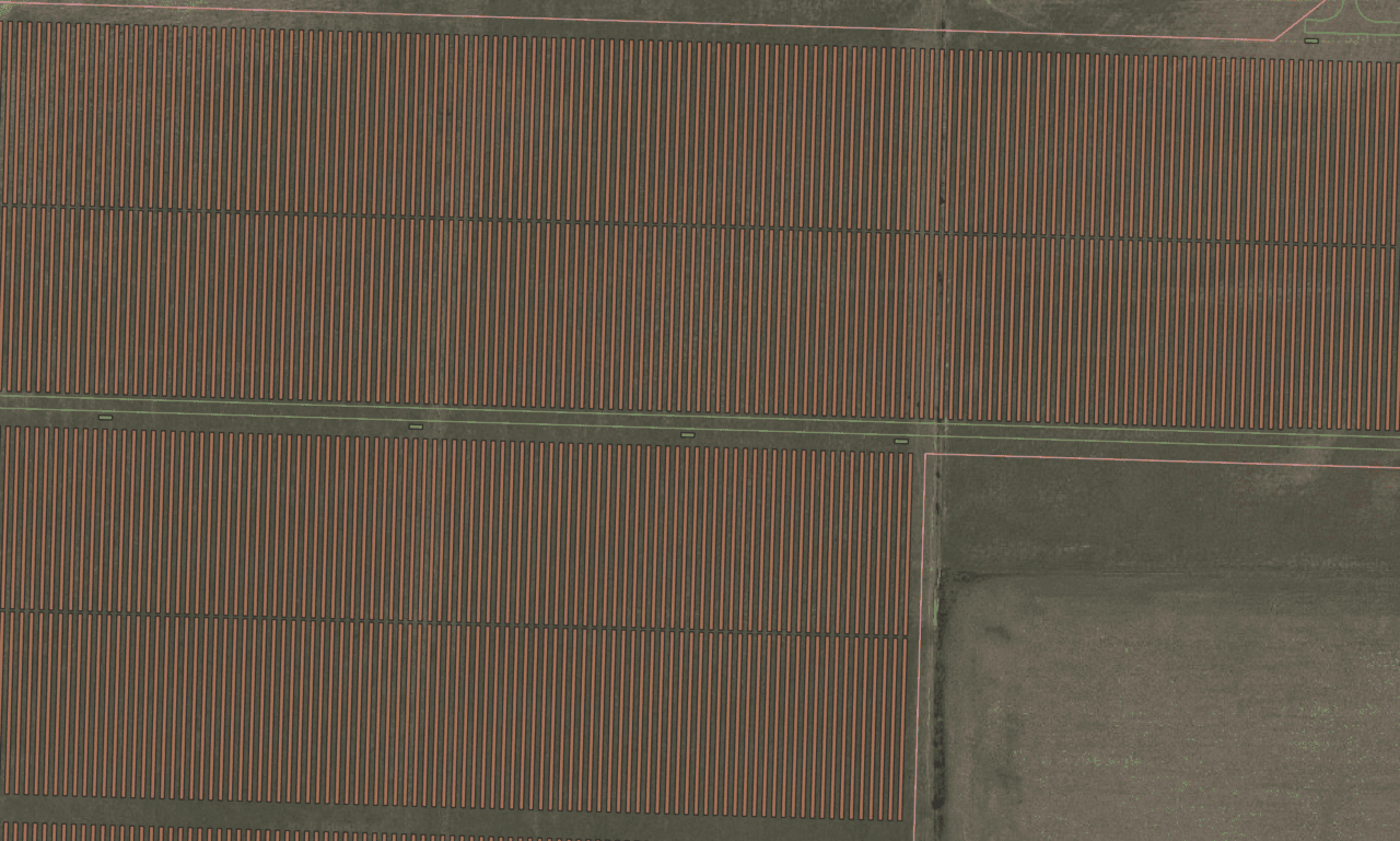
Also provide a page which shows the complete site layout. as illustrated here:
Providing KMLs
Please also provide geospatial renderings of your asset in the form of .kml or .kmz files.
This will allow for the most accurate digital representation of your solar farm and increase efficiency in the data-collection process.
Note: Providing KMLs is not a replacement for as-builts.
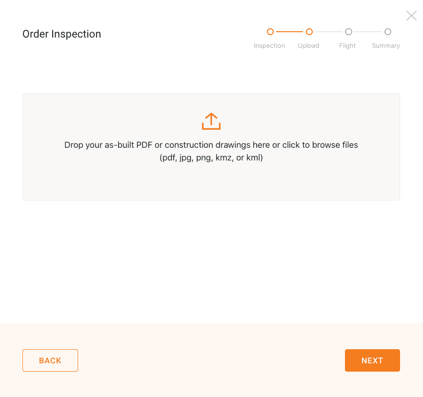
You can upload your KML while filling out the order form here:
The KML should ideally include fence lines, road boundaries and row/tracker outlines. It should also include equipment-pad locations and electrical-string-wiring information if possible. This is what a KML should look like:
These are KMLs with row outlines, road/fence boundaries, and equipment-pad locations.
If possible, the KML should also include electrical-string-wiring information:
Example of a KML with additional electrical wiring and labeling information.
If your KML does not contain row-orientation information, flight preplanning will be limited.
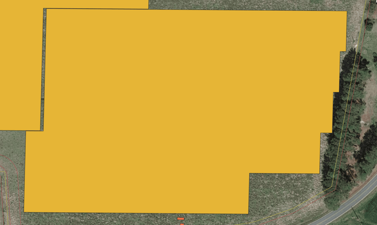
Example of a KML with only array outlines and no row-orientation information.
Please reach out to your internal team to obtain a more detailed KML, if possible. However, if the only KML available is the array outline, please submit it.
If you have other questions or are unsure, please contact support@raptormaps.com. We are happy to set up a call to discuss them.
Site Number FAQs
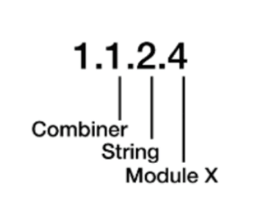
What is the purpose of site numbering?
Raptor Maps uses site numbering to provide an exact location of each anomaly down to the module level.We include this information in the report using either the Raptor Maps standard numbering scheme or a custom numbering scheme based on the numbering-scheme examples you provide.You’ll need to provide us with an as-built in either case.
What numbering scheme comes standard with Raptor Maps analytics?
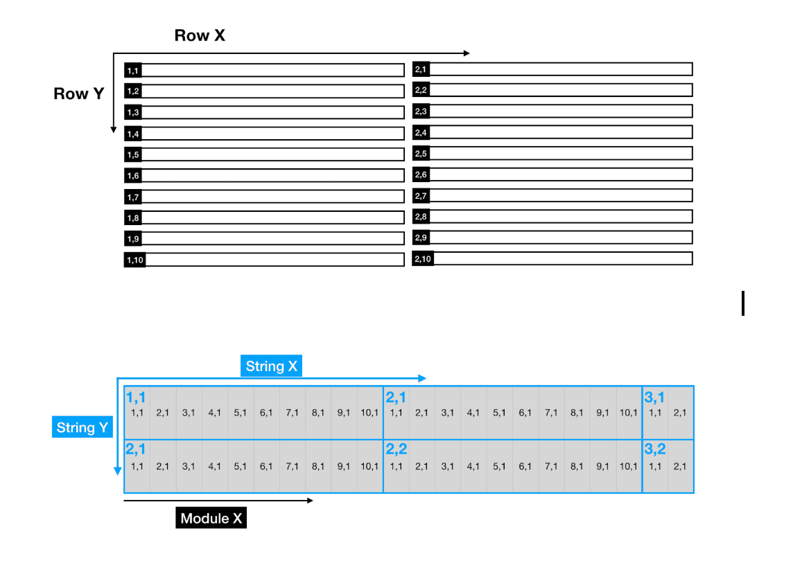
Raptor Maps numbering is based on a grid system in which rows, strings and modules increment west to east. Many of our customers find this scheme helpful as they count rows to make their way to an anomaly location.If the site layout does not fit the standard format, the site is also broken up into sections to further aid in field maintenance.
Can we use our own custom numbering scheme instead?
If you are using Raptor Maps to support maintenance and already have a numbering scheme in place that works well for your maintenance personnel, using custom numbering may make Raptor Maps easier to use.For example, if maintenance uses combiner locations as reference points for finding modules, you may want to use custom numbering.
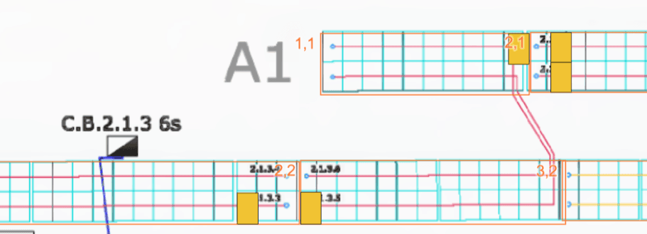
If I want custom numbering, what do I need to provide?
In order for us to include custom numbering in your report, you’ll need to provide an As-built with clearly defined Inverter – Combiner – String numbering.If this information is broken up across many pages of the as-built, please confirm which pages in the PDF we need to use. Raptor Maps will combine these into one base layer for the digital model.
More as-built examples are below.
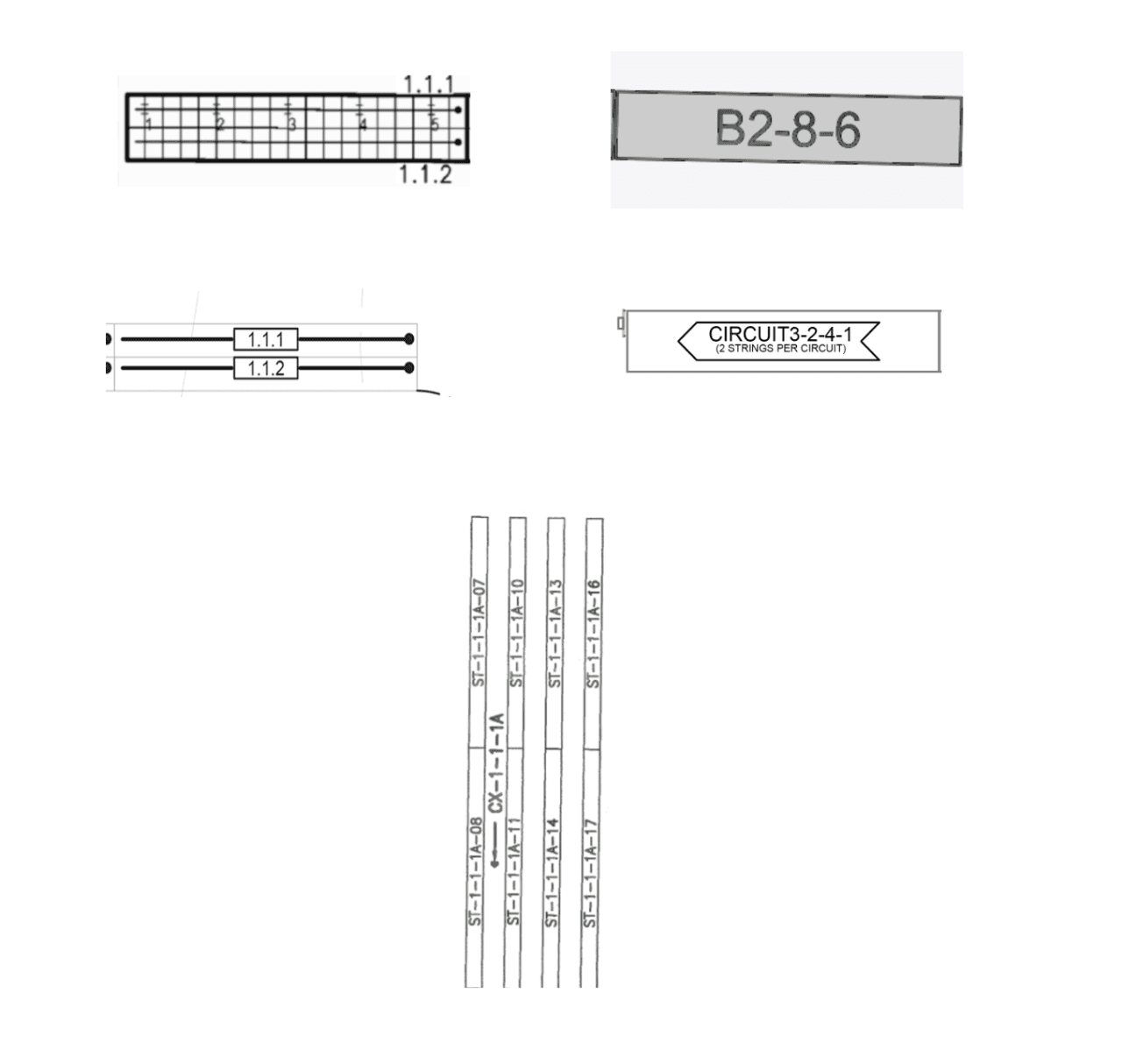
If you’ve requested custom numbering, it will appear as follows in the final report.