Posted On 11/30/21

“Solar staff scanning and logging PV module serial numbers in the field.”
Analytics and insights software platform, Raptor Solar, now includes regularly refreshed inspection analytics, normalization of data and a host of new productivity tools.
BOSTON, MA, November 30, 2021 ― Raptor Maps has launched several new features for its analytics and insights software platform, Raptor Solar, aimed at improving productivity, lifting performance and increasing ROI of solar assets. Their software-as-a-service platform for the entire solar lifecycle — from financing and construction through operations — is powered by machine learning and data that Raptor Maps has gathered from over 50 GW of solar power production across 40 countries.
Raptor Solar builds robust digital twins, or digital maps, of solar arrays. The subscription software platform now comes with regularly refreshed inspection reports that are input agnostic — drones, planes, satellites or sensors. The platform can even digitize, standardize and store third party reports.
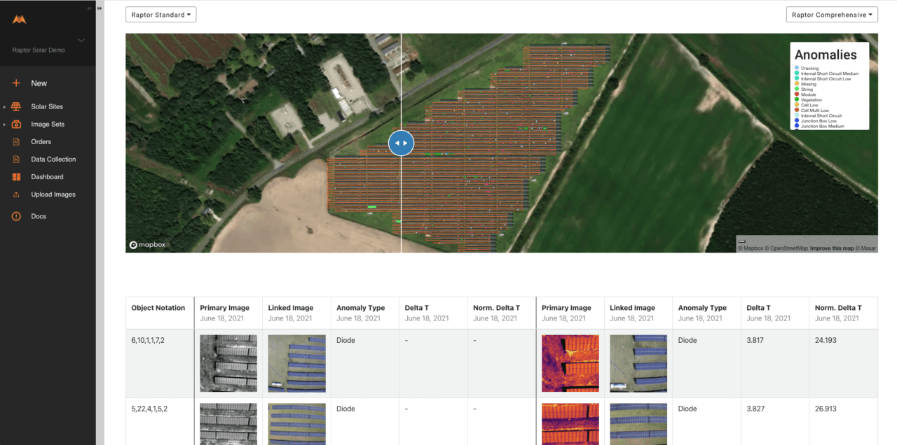
This enables customers to compare PV module inspection results and degradation over time for a bird’s eye view of solar assets. Users can visualize long term degradation, view recurring issues and trending anomalies as well as keep track of issue resolution. The software allows customers to quantify financial and production loss and even benchmark portfolios against their global database of PV system anomalies.
An industry-first, Raptor Solar also allows you to normalize inspection measurements with sensor and weather data across multiple inspections. Integrate inverter, combiner, pyranometer and other sensor data with inspection reports. Power production, irradiance and other data streams can all be imported, offering context around anomalies as well as more quantitative evidence of asset degradation. The software integrates with SCADA or DAS systems with a few simple clicks to automate otherwise time intensive processes.
This makes meeting BloombergNEF Tier 1 module OEM warranty requirements easier and faster. Using irradiance measurements, aerial thermography results are normalized to Standard Test Conditions (STC), allowing you to quickly get warranty claims processed with less back and forth.

“PV inspection report comparisons over time.”
Raptor Solar also now includes several productivity tools to allow teams to work efficiently and communicate effectively — from technicians to executives. The software provides a centralized and secure place to store inspection reports, documents, CAD files, technical specifications, performance models, warranty documentation, shipping receipts, photographs and data. Store all information in one place required for warranty claims, financial or M&A due diligence and general solar farm maintenance, enabling collaboration between parties. Raptor Solar also lets you download original imagery and data for a higher level of auditability.
“We saw an opportunity to accelerate solar industry performance with data, analytics, software and machine learning while making it easier to manage solar installations,” said Nikhil Vadhavkar, CEO & Co-Founder of Raptor Maps. “Customers have easily and quickly been able to deploy Raptor Solar, uniting previously siloed data and unlocking actionable learnings that increase productivity.”
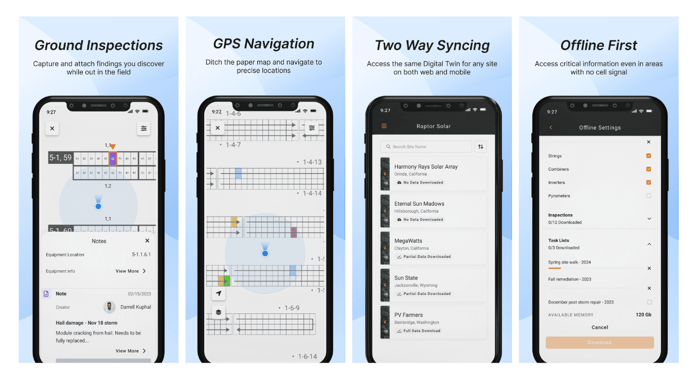
Additional new features include as-built field navigation and serial number geo-location. These build upon the company’s previously-launched barcode scanning and serial number mapping application, the first of its kind for the solar industry. An Android or Apple mobile phone or any Bluetooth scanner allows you to scan barcodes on PV modules, validate serial numbers against OEM verified data and store the data, geo-tagged to your as-built.
The serial number scanning app lets you verify solar supply chains for safe harboring and tax incentive eligibility. You can use the app to validate construction progress in real time or at mechanical or substantial completion. Technicians can scan serial numbers on site for location relative to anomalies. After repairs or replacement, subsequent inspections can confirm punch list completion. The mobile app can be used while on site to view data from inverters and weather stations. And the app lets users export serial number data to spreadsheets, including PV module latitudes and longitudes.
Globally, solar power is in the spotlight as many renewable energy companies seek to reduce the levelized cost of electricity and find innovative ways to identify and track issues with renewable energy equipment. Raptor Maps is one of few companies that provide PV aerial inspections powered by machine learning that meet the standards of the International Electrotechnical Commission. Raptor Maps inspections empower commercial, industrial and utility-scale solar owners and operators to take action on various types of solar equipment degradation, increasing performance and ultimately lifting ROI.
For more information about Raptor Solar, click here.
Contact us
Raptor Maps is building the digital foundation for a more resilient and scalable solar. From construction to end-of-life, we are your long-term software partners to ensure your sites are operating as expected and producing reliable energy to support the energy transition.


