Raptor Maps features a metadata tool that can be used to extract thermal data from IR imagery.
Note: Contact your org administrator to ensure that you have the “View all Image sets” and “Download all image sets” permissions enabled. Learn more about permissions here.
Access via Map View or List View
To use this tool, navigate to an inspection in Map View or List View, select Image Sets from the kebab (︙) menu in the top right corner of the screen, and select an Image Set to view. Click here to learn more about how data is uploaded and image sets are labeled.

Select an Image
Browse the “Image Set” list view to find the image(s) you want to analyze.
Tip: The map may be helpful for locating a specific image name, which can be searched with Ctrl+F.
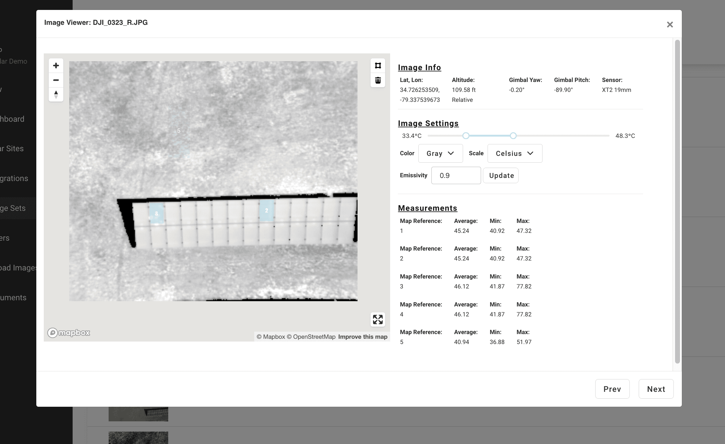
Select an IR image from the list view, and an Image Details window will appear.
Note: Images will appear normalized in this window. It may be necessary to change the image color to “original” to view.

Temperature analysis
You can view metadata for this image, including latitude and longitude, altitude, gimbal yaw, gimbal pitch and sensor technology. You can also see the temperature range based on radiometric metadata.
You can set the emissivity of the materials within the photography.
Note: The absolute temperature values will not be as accurate as temperature deltas until you set the emissivity.
To view custom IR metadata, use the polygon tool in the top right of the image to draw a box around a point on the image. Double click to complete the polygon once you have selected the desired area.

Once the shape is complete, image metadata with temperature measurements will appear (minimum, maximum and average temperatures within the shape you have drawn).
Note: for images tagged with anomalies, a polygon for each anomaly will already be present with thermal metadata.
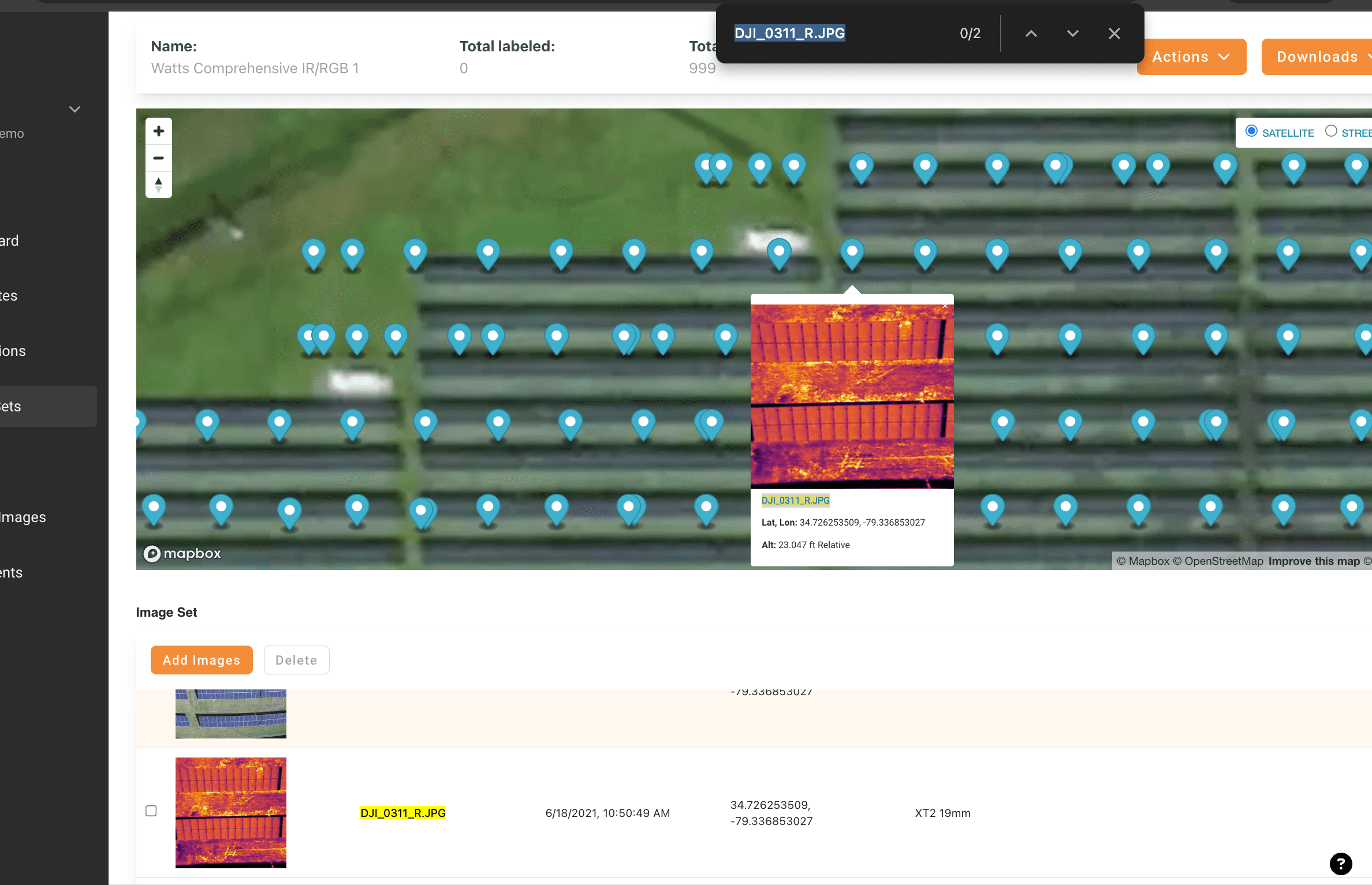
Overlaying All Inspection Imagery
In the Map View of an inspection, it’s possible to see an overlay of all inspection imagery. This imagery will not include anomaly boxing.
To enable this feature, select the Imagery toggle on the left control pane of the Map View. Image pins will appear on the map, and can be selected to open the image viewer. Note: It may be necessary to zoom on the map to see digitized array rows if they are obstructed by the image pins.

This feature can be used to view select deliverable types that consist of drone imagery without analysis, including Raptor Sentry use cases such as visual inspections of site equipment or infrastructure.