Getting Deeper with Raptor Maps
Read our latest thought leadership, research, best practices, and news.
Filter articles by selecting the Article Type above.
All Articles

Case Study
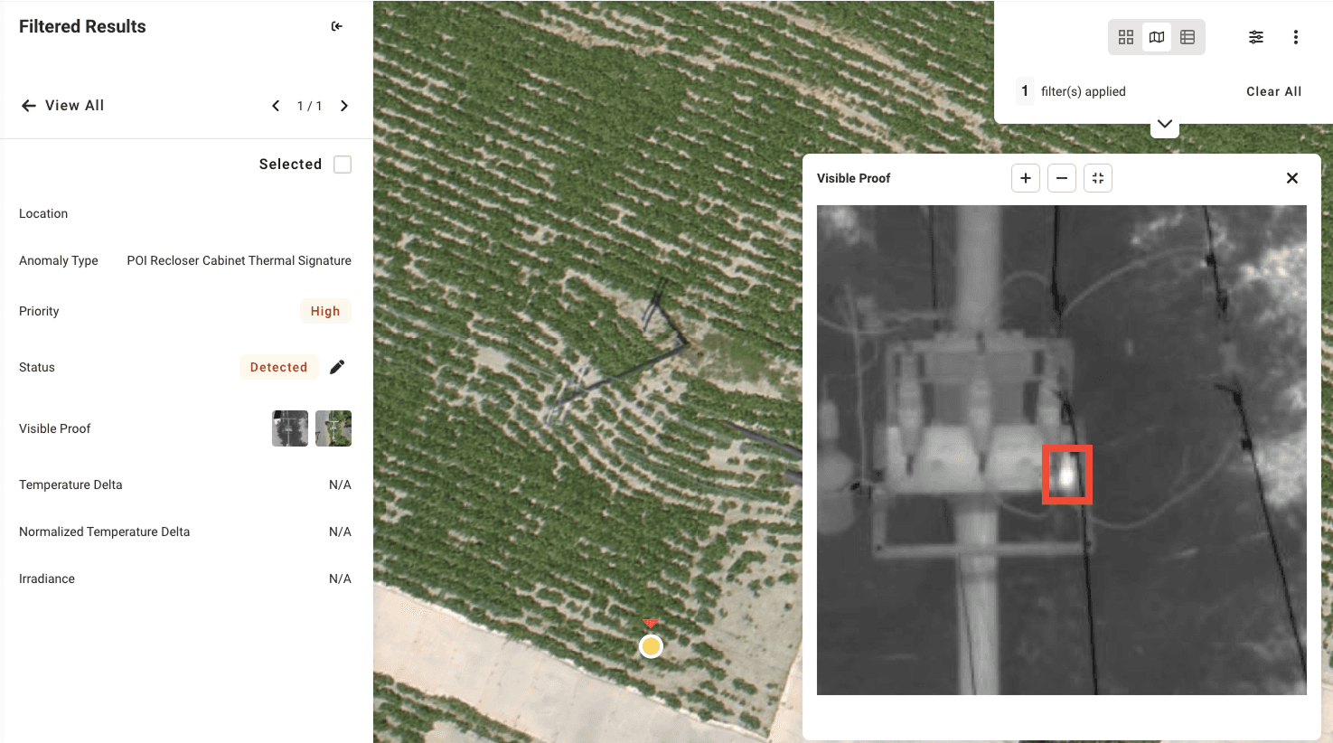
Case Study: How routine substation inspections prevented $450K+ shutdown
Posted on 6/26/25
Learn More
Product Updates
Custom Temperature Delta Analysis, Livestream Dashboard, and More: June Product Updates
Posted on 6/25/25
Learn More

White Paper
2025 Global Solar Report
Posted on 3/1/25
Learn More

Product Updates
Spring 2025 Product Updates: Livestream, Expanded Inspection Order Menu, and More
Posted on 3/27/25
Learn More

Research
Weathering the Storm: Analysis of Severe Weather Trends
Posted on 3/27/25
Learn More

Company News
Renewable Energy Technology Leader Gary Meyers Joins Raptor Maps Board of Directors
Posted on 1/28/25
Learn More
Load More
Filter articles by selecting the Article Type above.
All Articles
Case Study
Case Study: How routine substation inspections prevented $450K+ shutdown
Posted on 6/26/25
Learn More
Product Updates
Custom Temperature Delta Analysis, Livestream Dashboard, and More: June Product Updates
Posted on 6/25/25
Learn More
White Paper
2025 Global Solar Report
Posted on 3/1/25
Learn More
Product Updates
Spring 2025 Product Updates: Livestream, Expanded Inspection Order Menu, and More
Posted on 3/27/25
Learn More
Research
Weathering the Storm: Analysis of Severe Weather Trends
Posted on 3/27/25
Learn More
Company News
Renewable Energy Technology Leader Gary Meyers Joins Raptor Maps Board of Directors
Posted on 1/28/25
Learn More
Load More
Links & Support
Stay Up to Date
Subscribe to our newsletter and stay informed about innovations in solar asset optimization, deploying robotics for solar, our research and testing with OEMs, the latest in our product development, and more.
Links & Support
Stay Up to Date
Subscribe to our newsletter and stay informed about innovations in solar asset optimization, deploying robotics for solar, our research and testing with OEMs, the latest in our product development, and more.
Links & Support
Stay Up to Date
Subscribe to our newsletter and stay informed about innovations in solar asset optimization, deploying robotics for solar, our research and testing with OEMs, the latest in our product development, and more.