/
Aerial Thermography Ops — Manned Aircraft
/
Equipment Considerations for Manned Aircraft Inspections
Guidance Systems
For solar PV system inspection, two types of guidance systems are necessary for manned aircraft. The first is a general aviation app, such as ForeFlight Mobile or Garmin Pilot. In addition to guiding the aircraft to the correct PV system, the apps provide critical information to pilots such as weather, airport-specific information and communication frequencies.
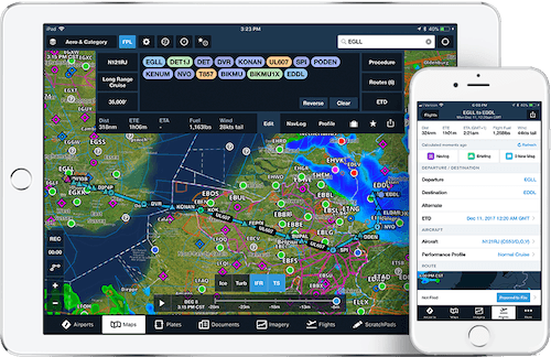
ForeFlight guidance app for manned aircraft. Source: foreflight.com.
⚠️ The app may not ingest latitude and longitude data required to pinpoint the PV system. Five decimal places are needed e.g., (42.35930, -71.09356), but this may be truncated by the guidance app. In areas with a high density of PV systems, pilots cannot solely rely on ForeFlight or Garmin, as the risk of inspecting the wrong PV system is high.
The second type of guidance system ensures that data has been captured for the entire PV system and there are no gaps in coverage. This can be accomplished with commercially-available control systems such as those used for crop dusting, skywriting and search-and-rescue. Vendors may also develop mobile applications that incorporate telemetry data from the aircraft, imaging system and/or tablet computer to both illustrate coverage and direct pilots.
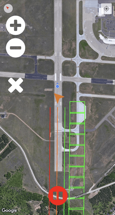
Raptor Maps coverage application for manned aircraft.
Green boxes indicate coverage, blue arrow indicates aircraft direction, and orange chevron indicates north.
Strafing
Strafing is the ability to move the camera independent of the aircraft in order to capture multiple sweeps without performing multiple aerial passes.
⚠️ When strafing, each camera pass will result in a more “extreme” angle, and the relative distance from the modules to the aircraft will increase, resulting in a lower resolution. If strafing occurs near solar noon on a tilt tracker system, the camera angle can exceed the manufacturer-recommended angle of incidence on rows that are farther away. For fixed-tilt PV systems or tilt tracker systems operating in the early morning or late afternoon, ensure that the rows being strafed are not obscured by rows closer to the aircraft.
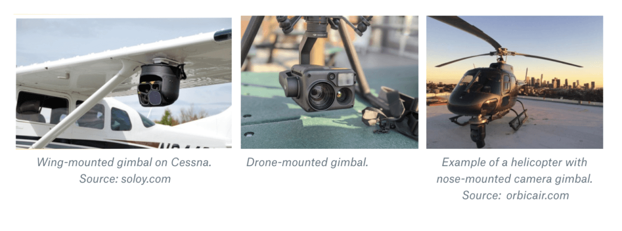
Gimbals
With fixed-wing inspections, strafing is accomplished by use of a gimbal. A gimbal system requires tight integration with aircraft positional sensors to ensure that it is pointed at the correct target at all times. Nearly all drones have gimbaled sensors as this data is already being processed onboard in order for a drone to function.
A gimbal that maintains a fixed field of view regardless is not strafing. In order to strafe, a gimbal must be programmed with the appropriate pattern to capture to the area of interest. For utility-scale systems, metadata from the gimbal must be associated with each radiometric image in order to ensure accurate coverage and facilitate analysis.
With helicopter inspections, strafing can be accomplished by manual effort from the data collection specialist. If the imaging system is mounted to a tripod, the human can pan the camera back and forth to strafe the area of interest.