What is Construction Monitoring?
Raptor Maps Construction Monitoring is an offering available as part of a Raptor Sentry subscription. Through this offering, Raptor Sentry customers will be able to regularly track progress of key elements during the construction phase of a solar project, and make informed decisions in managing their third parties to ensure timely completion within budget.
If you are interested in utilizing Construction Monitoring for an upcoming solar project, please reach out to our sales team here.
What are the steps for executing a Construction Monitoring project with Raptor Maps?
Provide essential site information to Raptor Maps
Issued for construction (IFC) drawings or alternative site layout.
Electrical drawings (showing row makeup)
KMZ
Project start and end dates
Optional: milestones for completing foundation, racking and modules
Row make up
Number of piles per standard row
Number of racking per standard row
Number of modules per standard row
Total counts (you can also input this in the app)
Foundations
Racking
Modules
Description of complete “racking”
Confirm construction activity for capture
Missions will cover “active” areas only. Please provide a construction plan indicating which blocks to fly throughout the project, or specific instructions ahead of each week.
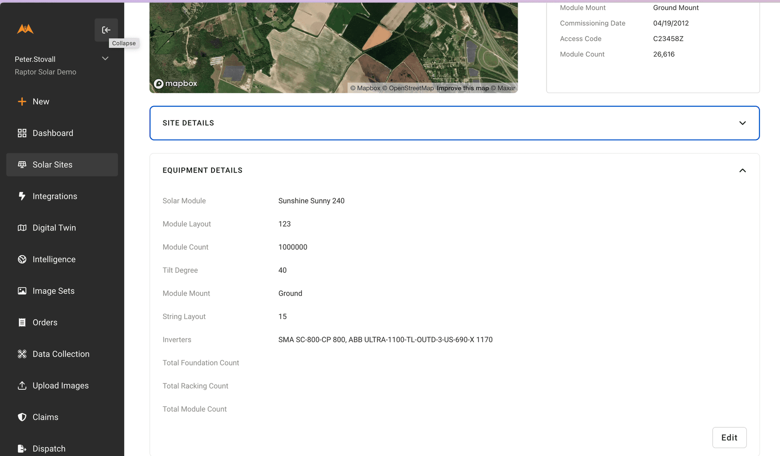
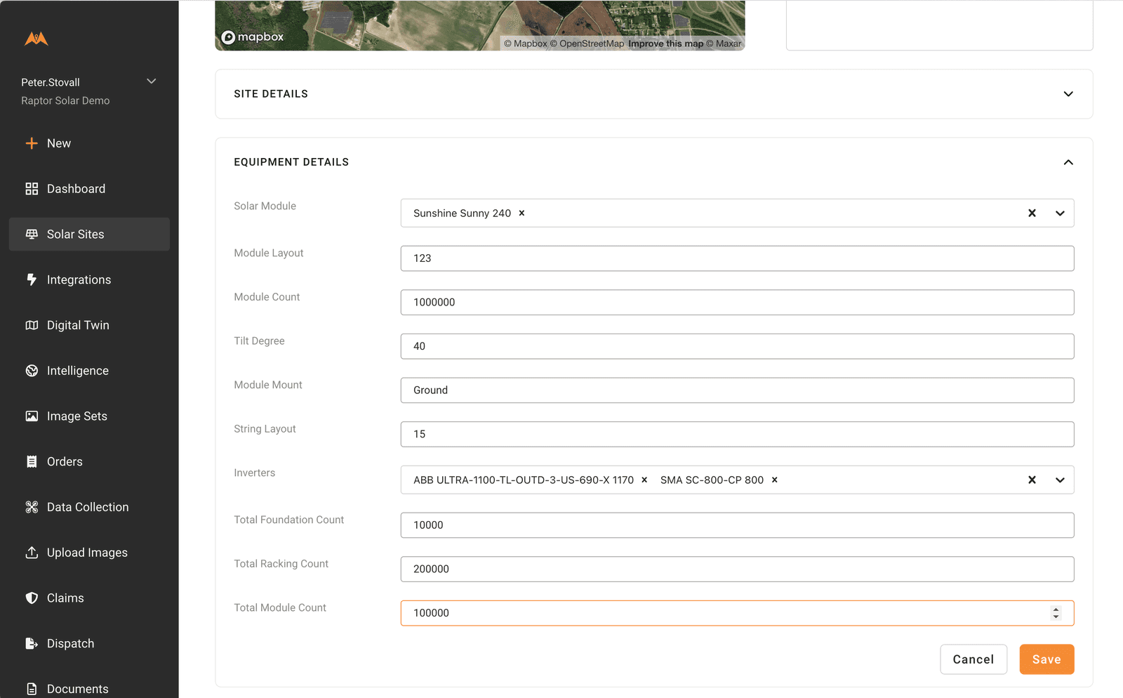
Update total counts for equipment (if not already provided during onboarding, or changes are required)
Click on “Solar Sites”
Select the site in question
Select “Site Info”
Open the “Equipment Info” section and click edit to update the total counts for foundations, racking and modules.
Remember to hit save.
These total counts act as denominators in the percentage calculations for each monitoring report.


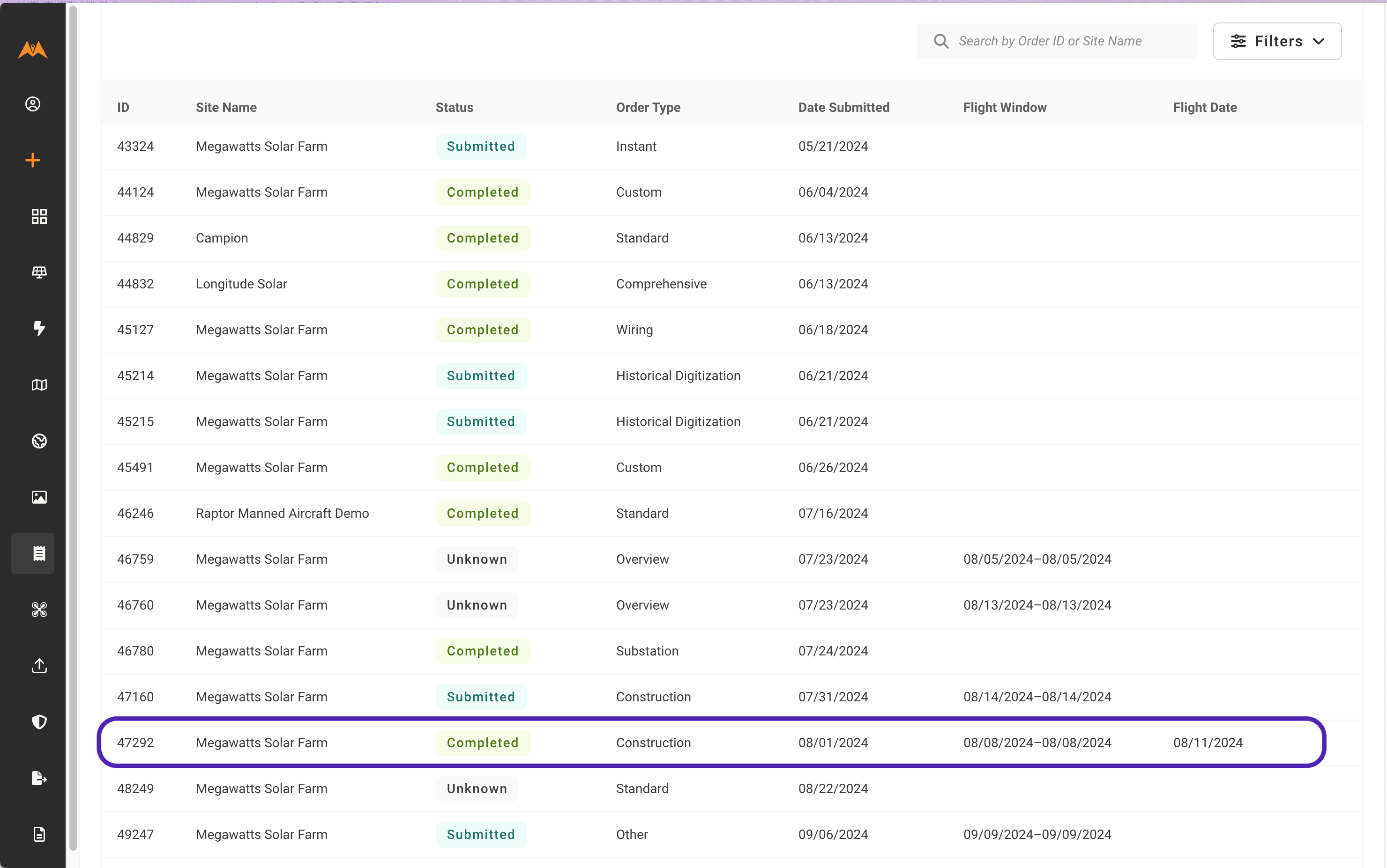
Check status of each order in the Orders page
Each progress report will show as an order in the Orders page. Raptor Maps will take care of creating these Orders at the start of the project.
You can check on progress by viewing the status of each order

Create a construction mission (if necessary)
For Raptor Sentry customers, Raptor Maps will create and schedule each mission in Raptor Flight so that regular analysis is available.
If for any reason, Raptor Maps is not creating the mission on your behalf, please create the mission and schedule it for the Flight Date displayed in the construction order.
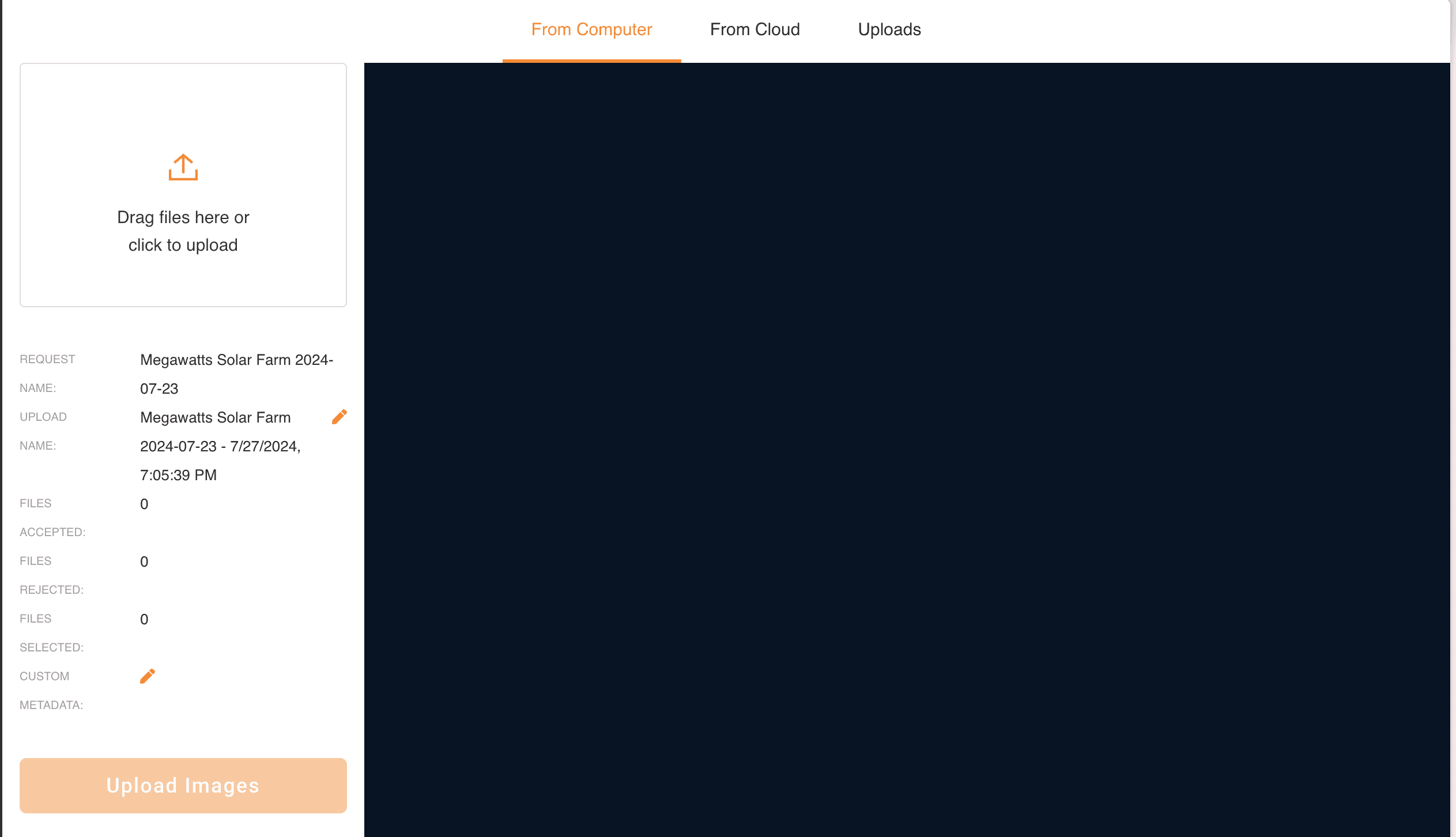
Upload data collected from each mission (if necessary)
For Raptor Sentry customers, Raptor Maps will execute each construction mission and upload the data collected.
If for any reason, Raptor Maps is not executing the mission on your behalf, please execute the mission on the flight data specified in the Construction order and upload the data using the upload link provided.

Order delivered
You will receive an email when the analysis is complete
You can also see this on the Orders page
Want to know how to see your Construction Monitoring deliverables? Click here.